Jomolhari Loop Trekking
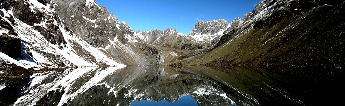
The most popular trek among the treks in Bhutan is the Jhomolhari treks. Of all, Jhomolhari loop is the shortest with altitude ranging from 2,500m to almost 5,000m from sea level offering wide range of views of landscapes, flora and fauna.
Drugyel Dzong to Shana Zampa
- Time : 5hrs.
- Ascent : 310m.
- Descent : 80m.
- Altitude : 2580m. to 2890m.
Walk along the dirt road through wide, rich, cultivated valley, beneath forest-covered mountains, following the Paro Chhu. You will encounter the first settlement comprising of big, magnificent traditional buildings with bright red chillies dried on their roofs in season. Not far from here, at Gunitsawa, you will pass army check point and your trekking permits will be checked and endorsed here. The Shana campsite is just half an hour walk from the check point.
Shana to Soi Thangthanka
- Time : 6-8hrs.
- Ascent : 685m.
- Descent : 0m.
- Altitude: 2890m. to 3575m.
This is a hard day as the altitude gain is above the limit. You will come across the first bridge en route from Tibet to Bhutan that was used by the travellers once upon a time. The trail climbs steadily through beautiful thick forest consisting mainly of, Oak, Rhododendron, Bamboo, Fern, Birch, Fir, Larch, Maple and Blue Pine. The route has lots of small rises and drops with a vision of amazing snow-capped Jhomolhari on the north. The hard day of walking comes to an end at Soi Thangthanka camp, which is in a big meadow.
Soi Thangthanka to Jangothang
- Time : 4-6hrs.
- Ascent : 469m.
- Descent : 0m.
- Altitude : 3575m. to 4044m.
The view of Jhomolhari fades away as you leave the camp inflowing forest on the way towards the Army camp. Late in spring, Blue Poppy (Bhutan’s national flower) has been spotted. The Military camp has Bhutanese and Indian army personnel guarding another pass to Tibet. The trail takes you through six remote villages and you might be invited into one of the houses for a cup of famous butter tea. After crossing the settlements, the summits of spiky peak Jitchu Drakey, Tshering Kang and Jhomolhari appear to get closer. Cross a bridge and suddenly the irresistible snow-and-ice- covered east face of Jhomolhari appears, with its massive 3200m- high wall of granite, marble, and quartzite. You have reached Jhomolhari camp.
Rest day at Jhomolhari camp
Rest day at Jhomolhari camp will help with acclimatisation as most people will feel the effects of ascending 1800m in three days. There are some good day hikes from the camp, and it is important to hike so that you will acclimatise. Follow the standard trek rule: trek high, sleep low.
Jangothang to Soi Yaksa
- Time : 6-7hrs.
- Ascent : 810m.
- Descent : 1,090m.
- Altitude : 4044m. to 3800.
- Bonte la pass 4890m.
The trail climbs steeply in the manner of zigzag, ascending after crossing a bridge of Jangothang. The view of overpowering peaks of Jhomolhari and Jitchu Drakey makes the journey worthwhile. Meadow roofed with flowers with several yak herders’ tents mark the end of the climb. The trail along the Tsho Phu Chhu is clear leading to a very beautiful valley. After passing few lakes with some long steep drops still with the view of Jitchu Drakey leading to Bonte La, the highest point of this trek. Few peaks can be seen from the pass.
The trail descends steeply from the pass and leaving the old Yak herders’ camp Soe Yaksa camp is reached. Soe Yaksa is a beautiful place.
Soi Yaksa to Thombushong
- Time : 4-5hrs.
- Ascent : 720m.
- Descent : 340m.
- Altitude : 3800m. to 4180m.
- Tagulun la 4540m.
Climbing from the camp through Rhododendron, Birch and oak forest decorated with moss leads to a grazing land. Cross the meadow on a good trail above the river leading to a chorten, huge cliff appears with the Sey Dzong wedged in it. After descending and ascending through the forest and a flat trail roofed with Rhododendron bushes, Tagulun La becomes visible on the skyline. The views of glorious peaks like Jhomolhari, Jitchu Drakey and Tsheri Kang, and in the distance Kanchenjunga and Makalu can be seen blocking the view to Mount Everest. From the pass, the trail winds gently downhill to a lush Thangbue valley. Thangbue camp is the second highest camp for the trek.
Thangbue to Shana Zampa
- Time : 4-5hrs.
- Ascent : 150m.
- Descent : 1380m.
- Altitude : 4180m. to 2890m.
Walk through the marshy valley to find a clear trail through Rhododendron bushes towards Thombu La. From the pass you can see snowy peaks of Bhutan, Sikkim, Nepal and Tibet. The walk from the pass is one of the best of the trek with a beautiful view through a hillside roofed with Edelweiss. The camp is near the helipad, a pleasing site by the Paro chhu.
Shana Zampa to Drugyel Dzong
- Time : 4hrs.
- Ascent : 80m.
- Descent : 310m.
- Altitude : 2890m. to 2580m.
A 4hr hike through the lovely valley, finishing at Drugyel Dzong where the transport will be waiting to take you to the hotel.